With hundreds of apps out there, we can map out the most efficient driving routes, share a location, look up traffic and road conditions, check the weather, and more.
Now imagine heading out on the water in a coastal community where there is active shipping, pleasure crafts, navigational hazards, and marine life all sharing the same space. With all that activity going on, you would have to use several different apps and navigation tools to get a real sense of what exactly is happening in this shared marine space. Wouldn’t having a digital platform that gathered all that data and allow users to share it, make the place safer, too?
Launched in May 2019, Transport Canada’s award-winning Enhanced Maritime Situational Awareness (EMSA) system—designed in collaboration with Indigenous communities— is one of more than 50 initiatives created under the Oceans Protection Plan, which celebrated its fourth anniversary in November. Alongside our partners, we’ve made major progress in preserving and improving the health of our coasts and waterways for the future.
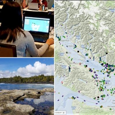
Thanks to satellite data exchanged through EMSA, mariners and decision-makers at sea, and on land, can get near real-time data to help them see what’s going on in the marine environment—not only to plan vessel routes, but also to get information on environmental conditions, from wind direction to ice thickness. Users can access and input information into EMSA to identify sensitive areas, share information about a whale sighting, or monitor activities and patterns on the water.
Before EMSA, it wasn’t possible for governments and Indigenous communities to access, connect to, and upload data for a complete picture of the marine environment—let alone by using the same tool. Now, users can capture and share all that information, transforming how we look at maritime activity and collaborate on projects and address maritime issues. For example, EMSA also helps with other Oceans Protection Plan initiatives, like proactive vessel management, increasing awareness of maritime activity, and informing environmental assessments.
“I’m truly impressed by what the EMSA team has achieved in under two years,” said Olivia Hall, Program Advisor at Transport Canada. “This system captures diverse information and data and tailors it to support community needs, while also helping create respectful relationships through several Indigenous partnerships.”
There are currently over 575 EMSA users, including 13 Indigenous communities, several academic and marine industry organizations, and federal partners like Fisheries and Oceans Canada, Environment and Climate Change Canada, and the Canadian Coast Guard.
“I‘m really happy to be part of this new approach and watch EMSA be a collaborative forum linking together Indigenous communities from across the country,” said Zachary Klaas, Program Policy Officer at Transport Canada.
“There’s never a dull moment on this job,” added Klaas. “The solution we’re jointly managing with our Indigenous partners is always changing and developing, and it’s rewarding to see the platform consistently improving over time.”
To find out more about EMSA, which was recognized with the 2020 Chief Information Officer (CIO) Community Award for “Embracing the Digital Mindset” last month, visit the Enhanced Maritime Situational Awareness initiative website.
